Silk Road Tours
Quick Enquiry
Silk Road Maps
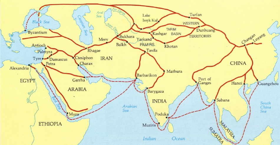
 As an ancient trading link between the east and the west, Silk Road, whose starting point is in China, passes through Asia, Europe and Africa.
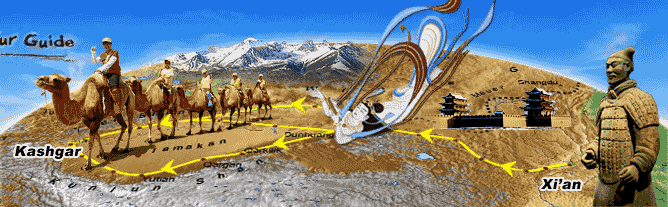
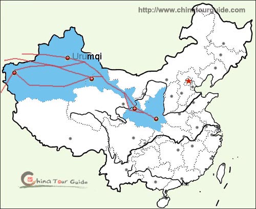
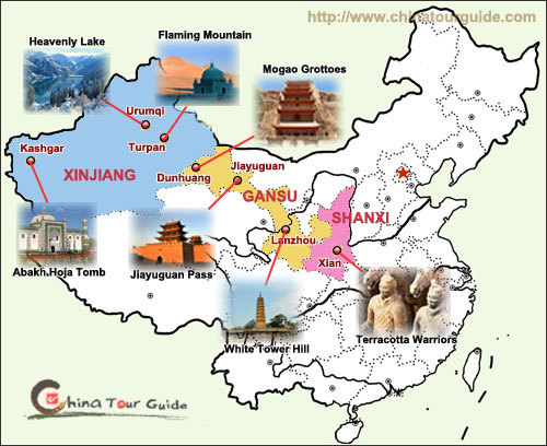
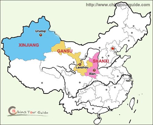
In terms of the transportation method, Silk Road is divided into land route and sea route. The overland one starts from Xian, past Gansu and Xinjiang, traversing Central Asia and West Asia, and then reaches Africa and Europe. The sea route sets out at the southeast coast of China, past South Asia, and arrives at Europe. (The left map illustrates the three provinces in China covered by Silk Road)
![]() The Complete Silk Road Map (Click to Enlarge)
The Complete Silk Road Map (Click to Enlarge)
 |
![]() The Route of Silk Road in China
The Route of Silk Road in China
 |
 |
![]() China Silk Road Tourist Map
China Silk Road Tourist Map
 |
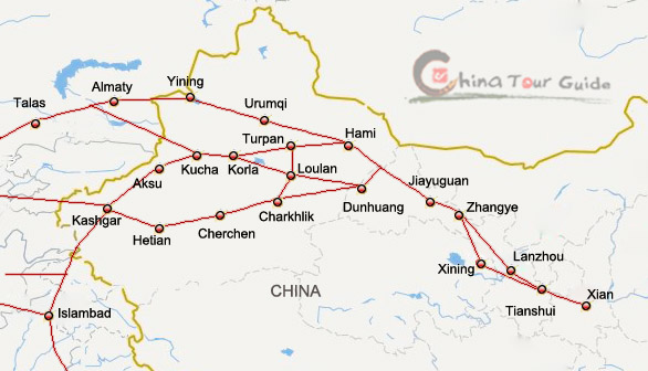
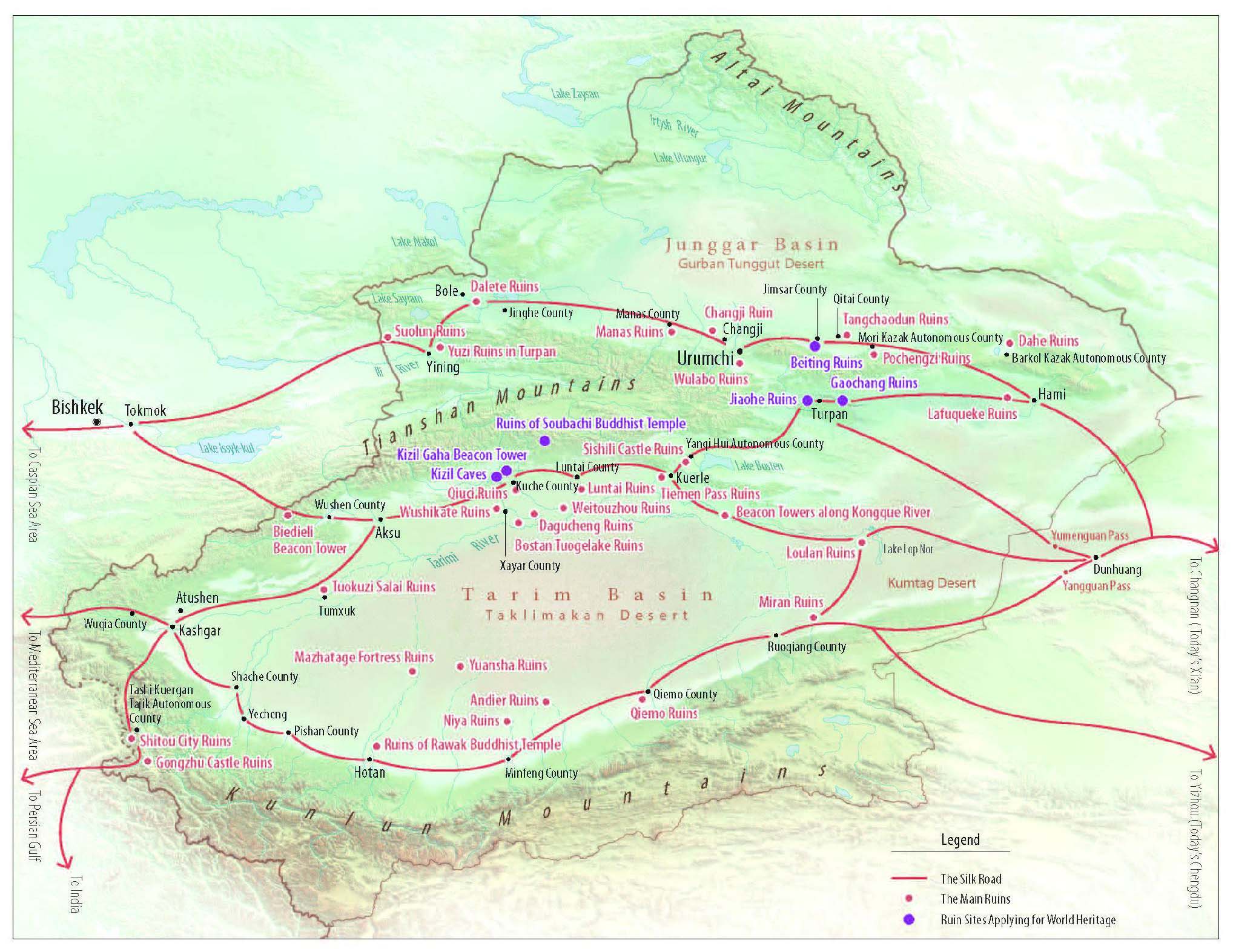
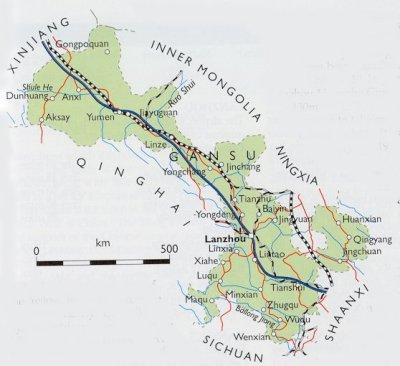
![]() Silk Road Regional Maps (Click to Enlarge)
Silk Road Regional Maps (Click to Enlarge)
 |
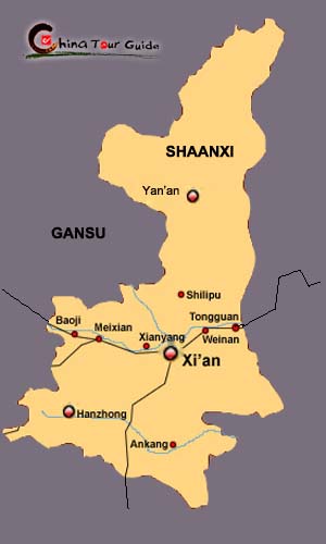 |
| Silk Road Passes Three Provinces in China | Shaanxi Province |
 |
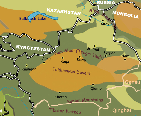 |
| Gansu Province | Xinjiang Province |
Guide for China tour,offers most value & amazing experience. In China,you can reply on us
Copyright © 2001 - 2025. All Rights Reserved to ChinaTourGuide.Com
Hotel Guangzhou | Guizhou Tours | Hong Kong Hotels | 棣欐腐閰掑簵 | 骞垮窞閰掑簵 | 骞垮窞浼氳閰掑簵 | Indochina Tour
Guide for China tours, offers most value & amazing experience. Chinatourguide.com. Your reliable China tour agency.